How the Farthest Frontier Can Help the Deepest Frontier: Space for Ocean Conservation
by Jessica Lis
Our oceans are vital for combating climate change and thus need to be conserved. Read how space technologies can help.
Space technologies are strong enablers of the UN Sustainable Development Goals (SDGs). Technology lies at the center of accelerating their adoption and space technology presents many unique solutions. UNOOSA’s Space4SDGs program stresses the importance of the role of earth observation and geolocation in supporting the achievement of these goals. Space-based technologies and services are pivotal to understanding climate change and disaster management, both which are significant to ocean conversation and SDG 14 – Life Below Water. Keep reading to learn how the Sentinel satellites play an important role.

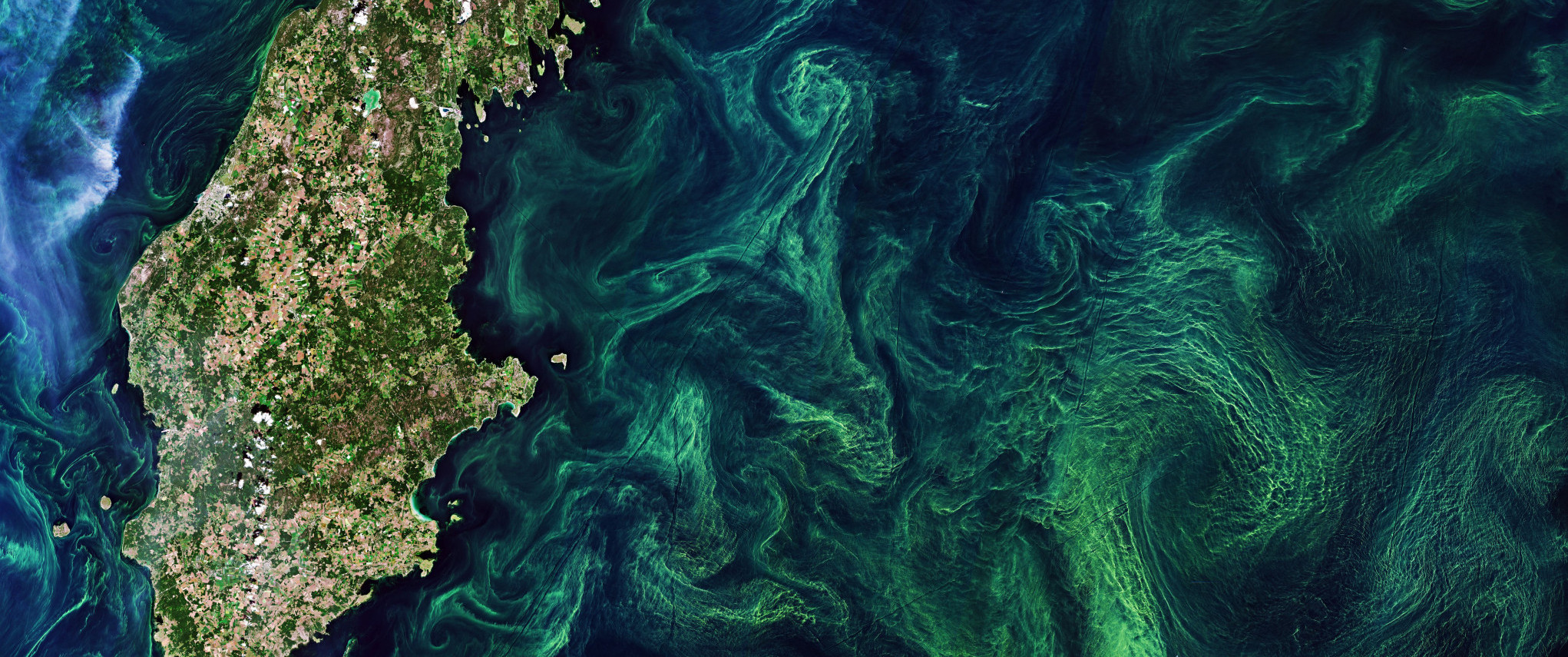
Credit: modified Copernicus Sentinel data (2019), processed by ESA, CC BY-SA 3.0 IGO
Climate change and the oceans are interdependently related: oceans play an important role in mitigating climate change and they acutely experience resulting effects. Oceans are disproportionately impacted by climate effects resulting from anthropogenic activity, including increases in carbon dioxide (CO2) and other greenhouse gases (GHGs). They absorb over 25% of human-produced CO2 excess and more than 90% of extra heat. This is depleting the ocean of oxygen (02) and leading to an increase in its acidification, which scales with the change in atmospheric C02 concentration.
Oceans are imperative to global environmental regulation in many capacities. SDG 14 – Life Below Water – focuses on conserving and sustainably using the oceans, seas and marine resources for sustainable development. It involves taking action towards ocean and sea monitoring, small island state development and sustainable tourism. Space plays an important role in ocean conservation. ESA’s fleet of Sentinel Earth observation satellites watch over the oceans and enable the monitoring of SDG 14 through measuring temperature, wave height, sea level, salinity, phytoplankton and sea ice. ESA also supports over 50 projects that directly contribute to SDG 14 including monitoring floating sargassum, a type of seaweed providing habitats for marine animals while obstructing fisherman, in the Caribbean and SCOOP, a project focusing on using Sentinel-3’s instruments to measure sea level in coastal areas.
It is important to understand the wide range of impacts on marine organisms, ecosystems, aquaculture, and fisheries. Earth observation data can help. In addition to climate modeling, coastal livelihoods and industries affected by climate change factors can also utilize this data to improve their resilience plans.
Earth observation data plays a significant role in marine conservation efforts regionally and locally. Remote sensing techniques can provide information about many relevant variables including: ocean bathymetry, sea surface temperature, ocean color, coral reefs, and sea ice. Specific to coral reefs, remote sensing can provide information on physical extent, benthic cover, bathymetry, rugosity, sea surface temperature, exposure, light, and carbonate chemistry. Additionally, data collection systems can be utilised on satellites to relay signals from ground transmitters to researchers in the field in applications like measuring tidal heights and monitoring whale migration.
The Sentinel satellite missions provide support to a variety of forms of marine monitoring by providing “timely, continuous and independent data on the behaviour, use and health of the oceans and associated coastal zones.” For example, Sentinel-1 is focused on providing a 24-hour radar imaging capability in all-weather for the Copernicus ocean services involved in many of these variables, including: the management and monitoring of the marine environment for conservation purposes, the monitoring of the Arctic environment and sea-ice measurement, as well as conducting open ocean surveillance to establish directional observations of wind and surface waves. Sentinel-1 contains a synthetic-aperture radar (SAR) instrument, which provides a constant capability to capture data at medium and high resolutions for coastal zones, ice observations and land areas. In order to cover the large range of incidence angle, the instrument provides fast scanning in elevation. It contains an internal calibration scheme, in which the transmit signals are routed into the receiver. This allows for monitoring of amplitude and phase to facilitate high radiometric stability.
Sentinel-2 is used for certain maritime monitoring capabilities including providing data on marine safety, marine resources, coastal and marine environment, weather, seasonal forecasting and climate for the Copernicus Marine Environment Monitoring Service (CMEMS). Sentinel-2 is used to effectively capture coral bleaching. For example, in 2017 Sentinel-2 captured the bleaching of Australia’s Great Barrier Reef.
The Sentinel-2A and Sentinel-2B Multi Spectral Instrument (MSI) provide remote sensing information on coral reefs. These instruments offer an advancement to previous coral reef data collection as they offer a 5-day revisit with 10m multispectral spatial resolution. Even when taking into account sun glint and cloud, they are likely to produce 20 clear images on average per year for a large proportion of reefs.
Sentinel-3 provides data on variables related to ocean topography. THE OLCI instrument contains five cameras that share the field of view and contain on- board calibration. The SLSTR instrument is a conical scanning imaging radiometer, which includes channels in the visible (VIS), thermal (TIR) and short wave (SWIR) infra-red spectrum.
Sentinel-3B offers increased accuracy in water quality monitoring. Its counterpart, Sentinel-3A provides data regarding the measurements of the ocean. Both satellites will utilize multiple sensing instruments to monitor the ocean. Ocean color is important in determining the health of the carbon cycle. It is also important as an indicator. For example, in clearer waters, phytoplankton influence ocean color through absorption of pigments such as chlorophyll-A. The greener the water, the higher concentration of phytoplankton and vice versa.
One of these sensing instruments is the OCLI instrument which measures ocean colour. Water colour is measured using a variety of channels. Different channels are used to measure different pigments such as chlorophyll, sediments, CDOM and reference in near infrared is important when measuring a dark ocean. Some challenges with the remote sensing of ocean colour data via spectrometer include atmospheric correction and calibration. Only 4% of measured radiation by satellite instrument comes from the water surface. As a result, atmospheric correction is vital to producing accurate information.
The data from these sensors is expected to strengthen and expand the observations database of ocean surface chlorophyll-A. Ocean colour information is used as a proxy for chlorophyll-A and phytoplankton biomass. This improved data will be used for models such as the global biogeochemistry forecast model (European Commission, 2018) and lead to improved accuracy in understanding ocean ecosystem dynamics. This improved understanding is critical to better monitoring and conserving marine resources. There is significant direct demand for this data by governments of EU Member States and other organizations working to implement SDG-14.
Sea surface temperature is a significant indicator of ocean health. It can influence the behavior of fish, lead to an increase in coral bleaching and affect coastal weather. The correlation between air temperature and the growth of coral colonies is well understood, but studies also suggest a strong relationship between sea surface temperature and coral reef growth. A study undertaken 2001-2014 illustrates a direct negative relationship. There are some challenges with measuring including that: coral only exists in the narrow, shallow coral is subject to no heat transfer in still water and warmer in rough water, and can relate to outside temperature where it increases or remains the same. Temperatures rising in the upper ocean are increasing the intensity and frequency of coral bleaching due to the ride in widespread thermal stress events.
Sea surface height is another important area where space technology can contribute to ocean monitoring. Currently, only altimeter instrument systems have the capability to measure sea surface height. This information can be used to determine ocean circulation patterns and sea levels. Radiometers measure the skin sea surface temperature at the top few micrometers at infrared wavelengths. However, there is a temperature drop of up to 0.5C across these top few micrometers, as well as day and night variations around the top meter of the ocean surface as a result of solar heating variations.
Successful measurements also rely on choosing adequate weather conditions in which to take the measurements. For example, clouds and light rain are transparent in the microwave part of the spectrum but heavy rains may pose issues. In the infrared, thick clouds are opaque because they are generally colder, hence providing a smaller brightness temperature than the surface. On the other hand, thin clouds are partially transparent in this part of the spectrum because even though they absorb surface radiation and emit their own, they emit less than they absorb due to the fact that they are colder.
Lastly, Sentinel-1 can contribute to sea ice monitoring by detecting changes in the Arctic sea-ice extent. This information can be used to assess environmental impacts on transportation (such as shipping) and overall impacts on coastal areas.
SDG-14 is enabled by space technologies that facilitate ocean/sea monitoring through a variety of instruments and applications. Our oceans are vital for combating climate change and thus need to be conserved. Coral reef and ocean health in general is imperiled globally but engaging new sectors in their conservation could lead to a positive outcome for these vital ecosystems. Space technologies can help.
Jessica Lis is currently SGAC’s Event Finance Manager and an analyst at Nomura Research Institute, focusing on emerging technologies and sustainability. She previously held positions at Bryce Space & Technology and Commercial Spaceflight Federation. She is an avid writer and has been published on various blogs and in academic journal New Media & Society.


